The National Mall looks deceptively simple: broad lawns, rows of trees and major public buildings arranged along long sightlines. That apparent clarity was constructed over generations. The landscape combines an eighteenth-century capital plan, twentieth-century redesign, reclaimed river ground and continuing public use. It is better understood as a sequence of connected civic spaces than as a single park completed at one moment.
A name with more than one extent
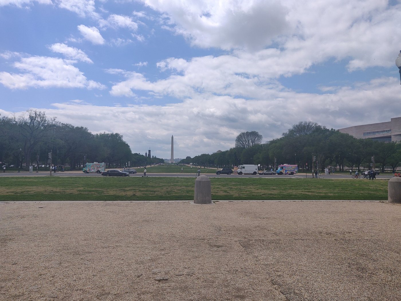
People commonly use “National Mall” for the entire monumental landscape between the Capitol and the Lincoln Memorial, sometimes including nearby memorials around the Tidal Basin. The more narrowly defined Mall landscape lies principally between the Capitol area and the Washington Monument. National Park Service management boundaries and everyday usage do not always describe exactly the same ground.
This distinction matters when estimating distances or interpreting a historical plan. A description of the tree-lined Mall does not necessarily include the Reflecting Pool, every memorial or all of West Potomac Park. Choosing a particular section gives a clearer sense of how its paths and buildings relate to one another.
An early idea, repeatedly revised
Pierre Charles L’Enfant’s 1791 plan envisioned a major public axis within the new capital. Andrew Ellicott’s subsequent work helped establish the plan’s published form. The intended promenade was not immediately realized as the open landscape visible today. Over time, different gardens, structures and transport uses occupied portions of the ground.
The 1902 McMillan Plan proposed a major reorganization. Its designers sought a more unified monumental center, with long vistas and a coordinated relationship between public buildings and open space. Calling this a simple return to L’Enfant can be misleading: it also reflected the priorities and design methods of the early twentieth century.
The plan required physical intervention. Buildings and other features had to be removed or relocated, and the landscape had to be reconstructed. A clean line on a drawing translated into a complex sequence of decisions about land, transport, government offices and existing plantings.
The lawns and elms are a designed system
Much of the familiar Mall landscape took shape during the 1930s. Frederick Law Olmsted Jr. played an important role in adapting the earlier plan, and major construction occurred between 1932 and 1936. The resulting lawns and rows of American elms established a repeated cross-section: open central ground, tree panels and paths, with institutional buildings beyond.
The trees do more than decorate the lawns. Their rows define the corridor, provide a sense of enclosure along its sides and help preserve the central view. The contrast between shaded edges and exposed open ground creates different conditions for movement and gathering.
Smaller features also belong to the composition. Benches, lighting and paths determine how the monumental scale is experienced by an individual pedestrian. Some former drives became walks, while cross streets either intersect the landscape or pass beneath it. The Mall’s apparent separation from ordinary traffic is therefore partly an engineering arrangement, not an absence of the city’s street system.
Temporary buildings had a lasting presence
Wartime office buildings occupied parts of the monumental landscape for decades. Their description as temporary did not mean they disappeared promptly when the immediate need ended. Removing them was part of the long process of establishing the landscape now associated with the Mall.
The National Park Service’s cultural-landscape account identifies 1971 as the removal date of the last temporary military buildings within its account of the Mall, followed by completion of a final tree panel in 1975. These late dates show how recently some apparently established elements reached their intended form.
West of the Washington Monument, the story also involves land reclaimed from the Potomac’s shallows and mudflats. The Lincoln Memorial’s position and its relationship with the Reflecting Pool depend on this transformed ground. What appears to be a natural stretch of solid land was partly produced through river and landscape engineering.
A ceremonial landscape that people can occupy
The Mall accommodates national ceremonies, political demonstrations, cultural events and ordinary recreation. Those uses place different demands on the same lawns and paths. A designed vista may be temporarily filled by a crowd, barriers or event infrastructure, while maintenance work can close areas that seem permanently open in photographs.
Public assembly is not incidental to the Mall’s identity. The ability of people to occupy the space gives the monumental setting a political life beyond its architectural symbolism. The buildings and memorials present official narratives, while gatherings can support, challenge or reinterpret them.
For a visit, one section can be more revealing than an attempt to cover the entire landscape at speed. The eastern lawns explain the relationship between museums and the civic axis; the western memorial landscape emphasizes commemoration, reclaimed ground and long water views. Together they show how a capital’s public space is continually made through planning and use.