
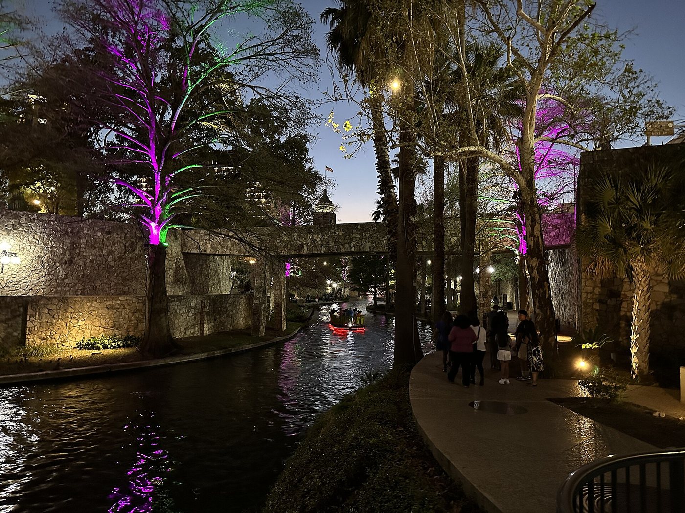
San Antonio’s River Walk is often pictured as a restaurant-lined channel below street level. That is one part of a much larger river landscape. The San Antonio River Authority distinguishes several reaches with different forms, connections and management purposes. Choosing a reach before choosing a route is the key to understanding the system.
The downtown image is only one section
In the center, the river’s relationship with street level creates an unusual urban arrangement. Buildings, bridges and paths operate at different heights, and a short distance on a street map may require finding a suitable stair or ramp to reach the water. The water-level promenade is therefore a second circulation system woven into downtown.
This helps explain both the appeal and the potential confusion. A visitor can be close to a destination horizontally while being on the wrong level or bank. It is more useful to identify a specific access point and bridge than to assume that every street touching the river offers the same connection.
Museum Reach and the transition south
The River Authority describes Museum Reach north of the central section, extending toward Hildebrand Avenue. Its urban extension opened in 2009. Farther south, Eagleland forms a transition between the dense downtown riverfront and the longer Mission Reach landscape.
These names describe more than marketing districts. They help distinguish different treatments of the river and its banks. A visitor interested in central-city buildings may choose one section, while someone seeking a longer walk beside planted banks may prefer another. Combining every reach into one itinerary can turn a varied river system into an unnecessarily long transport problem.
Mission Reach is an ecological project
Mission Reach extends roughly eight miles and includes a larger network of pedestrian and bicycle trails. The River Authority describes restored native grasses and wildflowers, along with a channel designed around pools, riffles and runs. The intended appearance is not that of a continuously clipped garden beside restaurant terraces.
That distinction is especially useful when vegetation looks untidy to an eye accustomed to ornamental park planting. Native river landscapes have seasonal changes, and their value includes habitat and water function. A riverbank can be actively managed without resembling a formal lawn.
Connections known as mission portals link the trail with the historic missions through access routes and interpretive artwork. The missions are separate destinations away from the main path in places; reaching one is not the same as passing it on the riverbank.
Build a route around crossings and exits
Use the River Authority’s map to select one reach, a starting access point and a definite exit. If the walk is one-way, settle the return journey before setting off. For a shorter visit, an out-and-back makes it possible to stop when the distance suits you without relying on an assumed crossing ahead.
A trail map is also more informative than a generic pin labeled River Walk. It identifies which bank carries a path and where bridges connect the sides. On shared sections, allow room for people cycling or traveling through rather than stopping across the full width for a photograph.
The river’s identity becomes clearer through these differences. Downtown emphasizes close contact with buildings and businesses; other reaches connect cultural destinations, neighborhoods and habitat. They belong to one river, but they do not offer an interchangeable experience.
.jpg)