
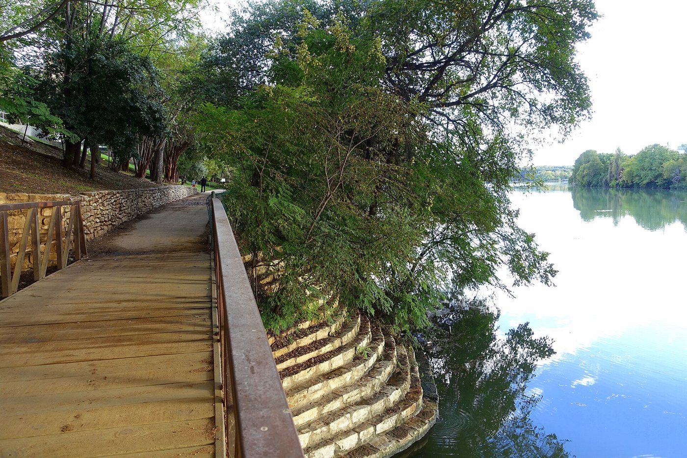
The Ann and Roy Butler Hike-and-Bike Trail surrounds Lady Bird Lake with a roughly ten-mile system used for recreation and everyday movement. Its continuity can make it feel inevitable, but the trail developed through advocacy and successive projects. The lake itself is also a managed landscape, formed by a dam rather than a natural lake untouched by the city.
A water-supply and power landscape became a public one
The Trail Conservancy’s history connects the lake with construction of Longhorn Dam and the needs of the Holly power plant. The trail emerged from efforts to improve a shoreline that had not been organized as the continuous public landscape familiar today.
A committee formed in 1971 brought together advocates including Lady Bird Johnson and Ann and Roy Butler. Their work helped turn the lakefront into a place for planting, walking and public access. The history illustrates a common urban transformation: infrastructure created for one purpose can become the basis for a different public use, but only through decisions about land, connections and care.
The boardwalk solved a specific gap
The southern shore once had a discontinuity that required trail users to leave the waterside route. The boardwalk project, opened in 2014, closed a gap of approximately 1.1 miles. It did not create the entire trail; it completed an important missing connection within an existing system.
A boardwalk changes the relationship with the shoreline. Instead of following every inland edge, the route can carry people across or beside the water while negotiating constraints on land. The experience is therefore different from a shaded path set back among trees. Exposed sections, viewing places and approaches to land each have distinct roles in the design.
A loop contains many shorter walks
Ten miles is a description of the overall system, not a recommended minimum visit. Bridges divide the trail into shorter possible circuits. A route selected around one or two crossings can combine views from both banks without committing to the full circumference.
Use the conservancy’s current map to identify the actual path and bridge connections. A bridge visible from the shore is not automatically the most convenient crossing for your intended route. The place where you can join or leave the trail matters as much as the distance measured along the water.
The trail is a shared corridor
People use the path at different speeds and for different reasons. Viewing the skyline and water works best from places where stopping does not block movement. A bench or widened area can become a destination in its own right, especially on a short walk.
The conservancy’s visitor information provides current guidance on facilities and use. For an urban-design visit, the strongest comparison is between the trail’s different types of edge: planted banks, built-up waterfront, bridge approaches and boardwalk. Together they show how a continuous route can be assembled from very different pieces without making every section look the same.
.jpg)
.jpg)
.jpg)