
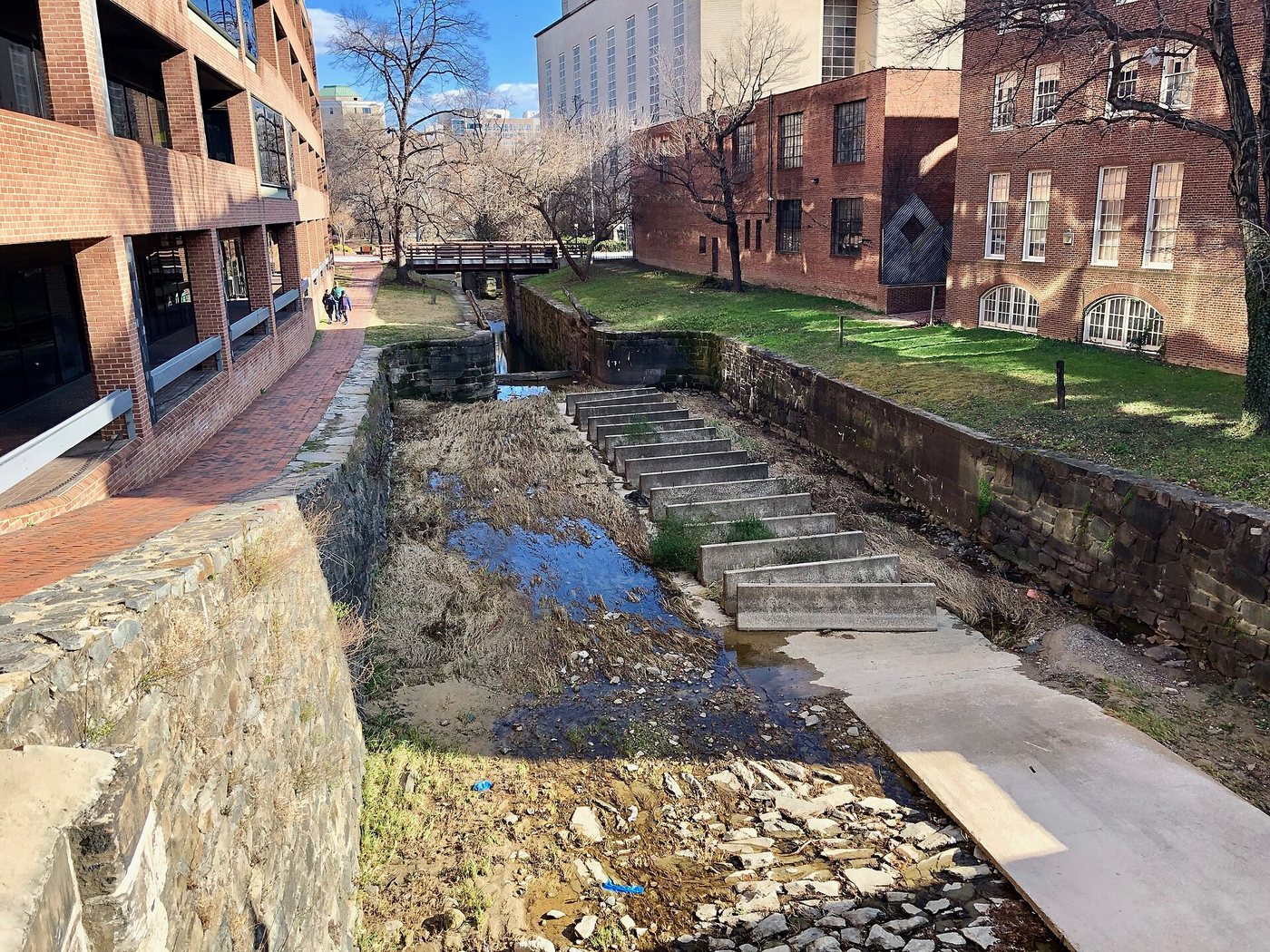
The Chesapeake and Ohio Canal begins in Georgetown, where a narrow waterway and towpath pass through an otherwise busy urban district. The canal’s quiet appearance can obscure its original purpose. It was a transport system built to move goods between the Potomac port and inland communities, using locks and animal power rather than the river’s current.
A project that stopped short of its name
Construction began in 1828 and reached Cumberland, Maryland, in 1850. The canal never extended to the Ohio River, despite the ambition recorded in its name. That gap between intention and completion is important: the surviving waterway represents a major undertaking, but not the full route its promoters imagined.
Georgetown served as the eastern end of the system. Its established port economy provided a place where canal commerce could connect with other forms of transport. The canal added another layer to an existing trading town rather than creating a settlement on empty ground.
Why locks are necessary
A canal boat needs water deep enough to float, but it cannot simply climb a slope. Locks solve that problem by enclosing a short section of water between gates. Raising or lowering the water in the chamber brings a boat to the level of the next section.
The Georgetown locks make this principle visible at a manageable scale. The canal is divided into controlled levels rather than flowing freely like the adjacent river. Masonry walls, gates and changes in elevation are therefore the working components of the system, not decorative features beside a path.
The towpath had an equally specific role. Animals walking beside the canal pulled boats along the water. Its alignment needed to support sustained movement, which helps explain why the path follows the water closely and negotiates crossings differently from an ordinary city sidewalk.
Industrial infrastructure within later streets
Buildings and bridges crowd the Georgetown section, making the relationship between water transport and urban development easy to see. A bridge carries street movement across the canal, while the towpath continues at another level. Several systems occupy a small amount of space without sharing exactly the same route.
The canal is now preserved as a historic landscape, and maintenance can affect water levels, gates and path access. A dry section does not make the lock geometry meaningless, nor does a full channel imply that historic boat operations are running. The physical evidence is most useful when read as a transport mechanism whose original commercial role has changed.
-1.jpg)