
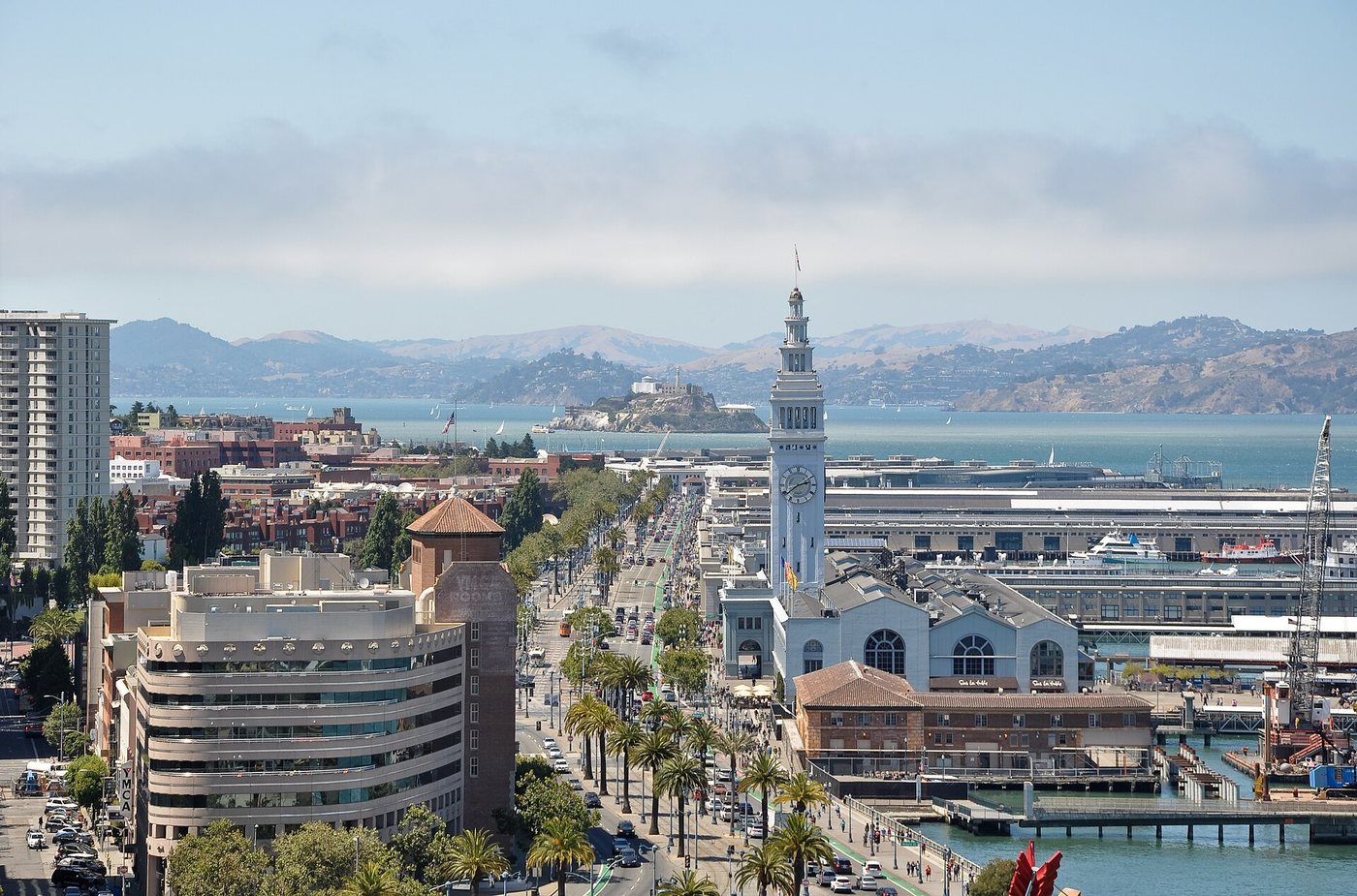
The Embarcadero is often experienced as a broad route beside San Francisco Bay, but the ground beneath it was created to support a working port. A seawall, wharves, piers and waterfront buildings established a durable edge where tidal marsh and shallow water had limited development. Later changes opened more of that edge to public use. Its present appearance combines maritime infrastructure, adaptive reuse and continuing questions about earthquakes and flooding.
An engineered shoreline
The Embarcadero Seawall was built in stages during the late nineteenth and early twentieth centuries. The Port of San Francisco describes construction between 1879 and 1916. Crews dredged a trench through bay mud, filled it with rock and rubble, and established a bulkhead and wharf system using timber piles. Land behind the new edge was then filled.
This process created more than a retaining wall. It established the foundation for a waterfront district, supporting roads, buildings, utilities and access to ships. The curving line of the seawall organized later development and remains one of the features that makes the waterfront legible as a connected whole.
The apparent boundary between land and water is therefore historical and constructed. A person walking along the Embarcadero is not necessarily following the shoreline that existed before the port was developed. The city expanded its usable ground and fixed a new edge through substantial engineering work.
Finger piers and their landward buildings
The piers project into the bay, allowing ships to approach structures connected with the shore. Their long forms provided space for loading, storage and movement of goods. At the landward end, bulkhead buildings presented a more architectural face to the city.
This distinction between working shed and public-facing entrance is important. A decorated facade could give order to the waterfront without changing the practical requirements behind it. Repeated entrances, pier numbers and the common seawall line helped turn many separate facilities into a recognizable port district.
Not every pier survived, and not every surviving structure retains its original use. The historic district includes remnants as well as complete buildings. Gaps and adaptations are part of the evidence of changing trade rather than reasons to imagine that the entire waterfront has lost its history.
A place of labor as well as commerce
The waterfront was a workplace whose history includes conflict over conditions and power. The 1934 Pacific Coast maritime strike is central to the district’s historical significance. The port’s documentation recognizes its connection with labor history and with labor leader Harry Bridges.
That history changes the meaning of the piers. They were not simply picturesque structures through which goods moved automatically. Their operation depended on people loading and unloading cargo, negotiating employment and organizing around dangerous and insecure work.
Today’s leisure uses can make that labor less visible. Historic interpretation helps connect the physical structures with the workers and disputes that shaped their operation. A preserved warehouse shell carries a different meaning when understood as a setting for contested working conditions rather than only as adaptable commercial space.
The city-facing edge changed again
The elevated Embarcadero Freeway once separated much of the waterfront from the streets behind it. After damage in the 1989 earthquake, its removal made possible a different surface-level relationship among the city, transit and the bay. The restored Ferry Building became an important part of that transformation.
The resulting public route did not replace every maritime function. Ferries and other waterfront activities continue alongside restaurants, offices, cultural uses and open spaces. The Embarcadero is a mixed working landscape whose uses change from pier to pier.
Preservation now includes resilience
The seawall’s age and the soft ground around it create seismic concerns, while rising sea levels add flood risks. These issues affect more than waterfront views: transport tunnels, utilities, historic buildings and access routes depend on the same edge.
The Port’s resilience projects propose combinations of targeted strengthening, flood protection and major reconstruction. A proposal is not a completed defense, and the exact work varies by location. The important historical point is that maintaining the waterfront requires another generation of engineering decisions.
The Embarcadero’s continuity lies partly in that repeated adaptation. Its first major transformation created a deep-water port; later projects changed public access and land use; current planning addresses future hazards. Walking the waterfront reveals the visible results of these decisions, while the most consequential structures often remain below the paving and waterline.

.jpg)

.jpg)