The Garden District is often introduced through a handful of large houses. A more revealing subject is the space around them: a planted setback, a side passage, an iron boundary and the distance between one roof and the next. These details show how land was divided and how a residential district acquired its character. They also explain why a walk here feels different from one through the tightly built streets of the French Quarter.
A suburb with a separate beginning
The area developed from land subdivided in the 1830s, including the former Livaudais plantation. It belonged to the separate City of Lafayette before New Orleans annexed that municipality in 1852. The Preservation Resource Center connects the district’s early large houses to merchants and financiers who prospered through the cotton economy. Those residences are evidence of commercial wealth, not a complete picture of the people who made that economy or maintained its households.
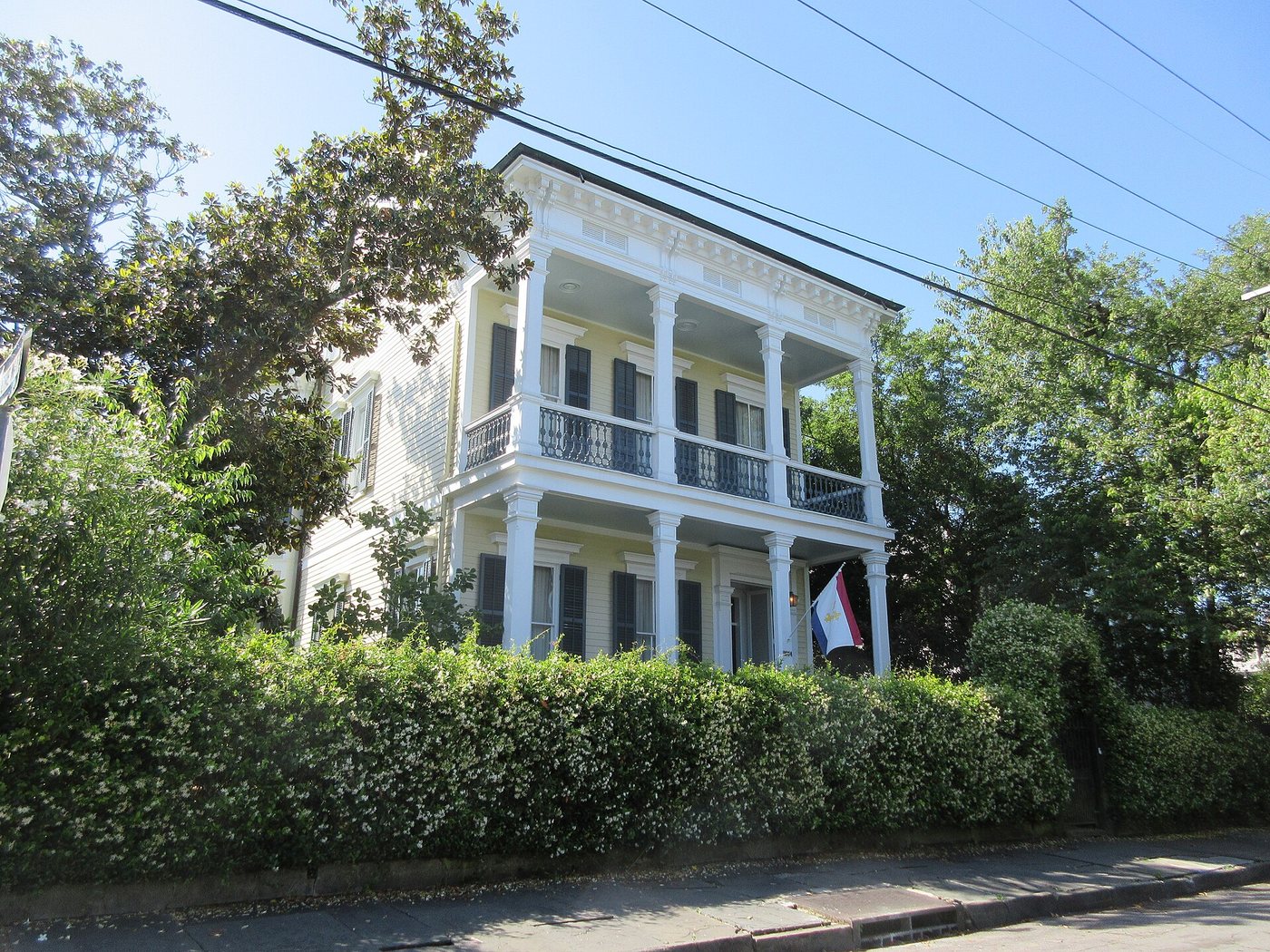
The word garden describes a development pattern as much as a botanical attraction. Buildings stand within plots with room for planting, rather than forming an uninterrupted wall along the sidewalk. A front gate marks the transition between the public street and a household’s land. A visitor can understand that arrangement from outside; the name does not imply a collection of public gardens.
Compare the ordinary pieces of a block
Choose a short section of Prytania or Coliseum Street and compare several properties without searching for celebrity addresses. First look at how far each house stands from the sidewalk. Then compare the width of the lot with the width of the building. A broad garden beside a narrow house produces a different street rhythm from a large building occupying most of its frontage.
Next follow the outline of the roof and porch. Columns and a strongly ordered facade can suggest a classical design, while deep eaves, brackets and tall openings can point toward Italianate influence. Treat these as clues rather than a mechanical dating system. The National Register documentation describes houses that combine Greek Revival and Italianate features, alongside later architectural styles. Alterations can also complicate an initial reading.
Smaller houses matter to this exercise. They interrupt the impression that the district consists entirely of mansions and make differences in scale visible. A useful photograph includes a neighboring building, fence or sidewalk as a reference; a tightly framed ornamental detail cannot explain the whole street.
The district was built in several campaigns
The city’s historic-district account identifies successive waves of building, including the 1840s boom, the years after annexation, the period following the Civil War and renewed construction late in the nineteenth century. The result is a layered neighborhood rather than a single architectural composition. Similar setbacks can connect buildings whose decorative details belong to different periods.
Historic-district maps also answer a different question from a visitor map. A local regulatory boundary, a National Register boundary and a loosely used neighborhood name need not cover identical parcels. Use the city’s map when asking whether a particular property belongs to a designated district; use street names and a current map when choosing where to walk.
Make the walk about observation
The commercial life along Magazine Street offers a change of scale from residential blocks. Rather than trying to cover every named house, connect a few streets with that edge and notice where entrances, shopfronts and pedestrian activity become more frequent. A compact loop leaves time to examine the relationships between buildings.
Keep doorways and gates clear, remain on public sidewalks and avoid treating private porches as viewing platforms. If an interior visit or Lafayette Cemetery No. 1 is important to your day, establish its current access separately before setting out. A neighborhood walk does not depend on entering either. The streets, boundaries and varied house forms already provide the material for understanding how this part of New Orleans grew.