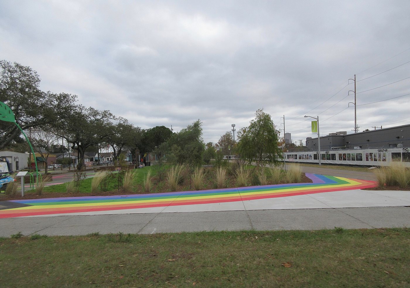
The Lafitte Greenway makes more sense as a line through the city than as a single destination. Its approximately 2.6-mile route links neighborhoods through a landscape designed for walking, cycling, drainage and everyday outdoor use. The long, relatively direct alignment is a clue to what occupied this ground before it became a park.
Transport left the shape
The Carondelet Canal opened in the 1790s to connect the area near the French Quarter with Bayou St. John. A path beside the canal developed into a promenade known as Carondelet Walk. Railway use subsequently added another transport layer, while the canal itself was filled during the twentieth century.
These changes were not simply one picturesque use replacing another. Water transport, rail movement and recreation each demanded different surfaces, widths and connections. The present greenway inherits the corridor’s continuity while using it for a different public purpose. Opened in 2015, it turns a former transport strip into neighborhood infrastructure.
Read the park at its crossings
Choose a manageable section and pay attention to the points where ordinary streets cross the greenway. A continuous path on a map still meets the city’s street network on the ground. Compare how a crossing interrupts movement with the stretches where planting and open space allow the route to feel more self-contained.
The park’s stormwater features are another important layer. Low planted areas and drainage landscapes are working parts of the design, rather than leftover ground awaiting ornamental flower beds. Try looking across the width of the corridor as well as along its length: path, planting, activity space and neighboring buildings each occupy a different band.
A route for local use
The greenway organization describes the park as a place for community activity as well as transportation. That distinction matters when planning a visit. A short walk that observes adjoining streets and entrances may reveal more than covering the entire distance without stopping.
Use the official route information to pick a start and finish that suit your onward journey. At busy points, leave room for people using the trail to reach work, shops or home. The corridor’s success cannot be measured only by how scenic it looks in a photograph; its connections to everyday destinations are part of its purpose.