
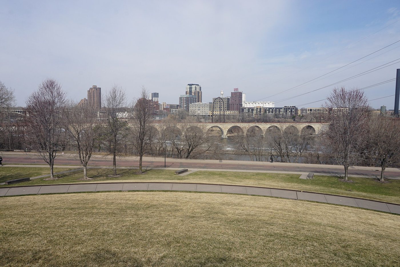
The Stone Arch Bridge curves across the Mississippi below St. Anthony Falls, turning a former railway route into a place to experience Minneapolis on foot. Its name describes most of the structure, but not every span. The interruption in the masonry is an important part of the bridge’s history, rather than a detail to overlook.
A railway alignment in stone
Constructed between 1881 and 1883, the crossing was part of James J. Hill’s railway expansion. Engineer Charles C. Smith designed a bridge approximately 2,100 feet long with 23 original arches and a curved western approach. That curve is particularly legible from the deck, where the route gradually changes the view ahead.
A railway bridge must connect usable alignments on both sides of a river; a direct perpendicular crossing is not always the most useful solution. Here, the curve is a reminder that the structure belonged to a larger transportation system. Its present recreational use preserves a geometry chosen for trains.
Why one section is different
In 1962, two original spans were replaced with a steel Warren deck truss to provide clearance for vessels associated with the Upper Harbor project. The change makes a second transportation system visible within the first: river navigation required an alteration to the railway crossing above it.
Stone arches transfer loads through curved masonry into their supports. A truss uses a framework of connected members to span an opening. Seeing both within one crossing offers a clear comparison without treating either as merely decorative. The material difference records a change in operational requirements.
A slower crossing
The bridge now serves pedestrians and cyclists. Its relationship to the falls and surrounding mill district makes it useful as more than a connection between banks. Walking allows the curve, piers and changing angles to become part of the experience instead of passing beneath a train almost unnoticed.
For a visit, distinguish the view from the deck from views of the bridge itself. On top, the alignment and river are prominent; from the banks, the sequence of arches is easier to understand. Use current route and maintenance information when planning the crossing, and leave the moving path clear when stopping to photograph the water.

.jpg)
.jpg)

.jpg)